The medieval history of famous Yadava State Karauli and it's nearest places of interest --
The Mediaeval history of famous Yadava State Karauli and it's nearest places of interest ----
Karauli town--
Once the capital of the erstwhile state and now the headquarters of the sub-division, tahsil and panchayat samiti of the same name, Karauli is situated (1)at 26 30 north latitude and 77° 02′ east longitude. Hindaun on the Bombay-Delhi broad guage line of the Western Railway is its nearest railway station. It is linked with Gangapur (40 km), Hindaun (32 km), Kailadevi (26 km.). Sawai Madhopur (86 km.)(2 )and Jaipur (176 km.)(3 )by tarred roads. It occupies(4 )an area of 35.00 sq. km.
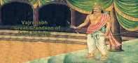
Karauli Like the Bhatis of Jaisalmer, the chiefs of Karauli also belonged to the Yadava clan of Rajputs. This Yadava dynasty of Karauli began with Vijayapala, who is said to have migrated from Mathura and settled in the hilly region, where he laid the foundation of the fort and the capital of Vijayamandirgarh in 1040 A. D. This fort later on came to be known as Bayana (now in Bharatpur). Tahanpala (1093-1159), son of Vijayapala, was a powerful king of this dynasty. In the course of a long and strong rule of sixty six years, he increased his power by constructing the fort of Tanangarh (the Thankir of Persian historians), 14 miles (22 km.) from Bayana, and by making fresh conquests. His extensive political power is evidenced by his title of Parambhattaraka maharaja dhiraja Parameshwaras. Tahan Pal was succeeded by his son Kunwar Pal. During his reign, Muhammad Ghori attacked Tahangarh and cap tured it. The government of Tahangarh was conferred on Baha-ud-din Tughril. A short Sanskrit inscription dated Samvat 1244/1187 A. D. on one of the pillars at the gateway of fortress refers to the fort that about 9 or 10 years before the Muhammadan conquest, the city of Tahangarh was one of the great Shaivite centres¹.
After the fall of Tahangarh, the Raja retired into the jungles. The two succeeding rulers, could not regain their patrimony. From 1196 to 1327 A. D. the chronology of this line is uncertain. It seems that this period was marked by disorder and decline of this dynasty.
This town is said to have been founded in 1348 A.D by Raja Arjunpal of the Lunar race Yadava rajput dynasty. It was originally called Kalyanpuri after the temple of Kalyanji (5, 6 ) built about the same time. The town was also known by the name Bhadrawati, after the river, which flows close by. The town has had many vicissitudes during its life .
Karauli is a fortified town surrounded by a wall of red sand stone strengthened by bastions at several places. The circumference of the town is about 3.7 km. with six gates (Hindaun, Vazirpur, Nagar, Dhud, Nadi (river) and Masalpur) and 11 posterns. The wall has, however, crumbled down at some places. The town has stone-paved narrow streets with an uneven drainage system. The principal market runs from east to west There is a beautiful palace built by Maharaja Gopaldas, surrounded by a lofty bastioned wall with two gates. The Rangamahal and Diwan-i-am inside the palace are colourfully decorated with mirrors.
The town has many temples, noteworthy among them are the temples of Madan Mohanji (7) Gopalji and Pratap Siromani. The sanctum is surrounded by a raised corridor with decorative paintings and the main idol of Madan Mohanji is of black marble stone brought by Maharaja Gopaldas from Jaipur. The Sabhamandap is covered with a tin sheet supported by iron pillars and the floor is paved with black and white marble tiles. On every Amavasya, there is a special congregation that often exceeds 10,000. Another temple which attracts devotees is that of Gopalji The idol of Gopalji's temple is said to have been brought from by Maharaja Gopaldas. The beautiful temple of Pratap Siro mani was built by Maharaja Pratap Pal in the later half of the 19th century. Among Jain temples, the Digambar Jain Mandir, situated in the main market, deserves notice. The Jama Masjid and Idgah are places of Muslim congregation.
The town has many fine buildings including the palaces of the ex-rulers of Karauli The Dak Bungalow is a palatial building set in a beautiful garden. There are also many Dharamshalas, lodges and tea stalls in the town. Tongas and cycle rickshaws are the local conveyance. There are libraries, reading rooms, a cinema halls and a club in the town, besides three private gardens.
Karauli is a municipal town It has a small grain mandi. Banking facilities are provided by the branch offices of the State Bank of Bikaner and Jaipur, the Bank of Baroda and the Sawai Madhopur Central Co operative Bank Ltd. The town is known for its export of stone used in con struction of buildings including the latticed windows, images, white stone Chakla (pastry board), Kund (stone bowl) and Khatott (a type of stone basin) of red sand stone. The stone quarried in the vicinity of the town is of three colours viz., white, red and mixed, locally called Gazat (brown in colour). The town is known for its wooden toys specially lotus flowers and peacocks. It is also a centre of Khadi Industry and there is a separate wing in the market called Khadi Bazar. Besides, Biris and daggers of fine craftsmanship are manufactured here.
Kaila Devi Temple (Lauhra village)--
Lauhra, better known as Kaila Devi, is a small village in the vicinity of Kalisil river and a dam of the same name in Karauli tahsil situated(13) at 26°20' north latitude and 76°52' cast longitude. The village is known after Kaila, the tutelary deity of the ex-rulers of the erstwhile Karauli State. It is 26 km away by road from Karauli (14) and is well conne eted with Gangapur city, Hindaun, Bharatpur and Mahwa by road. The nearest railway station is Hindaun from where buses ply regularly to Lauhra. The village has an area (15) of 17,858 acres.
A large fair (16) is held here during the dark half of Chaitra (March April) and lasts for a fortnight in which devotees of the deity come from far and wide. The congregation during the fair exceeds a lakh and Puja is offered with coconuts, sweetmeats, clothes etc. The fair is also called Nritya Sangeet-ka-Mela after the famous Langura Balvir (a folk song) and dance which is the centre of attraction. During the month of Ashwin, another fair known as Chaurasi Bhog-ka-Mela is held here.
The main temple is of marble and houses an idol of Kaila (goddess Maha Lakshmi) and another of Chamunda Devi. Kaila is an eight armed deity and is shown seated on a lion and only her face is exposed to Darshan. Other subsidiary shrines are those of Jagdamba (mother goddess) Ganesh Langura Balvir and Bahura Bhagat.
The village is served by an Ayurvedic dispensary, a police station, a Patwarghar, primary and middle schools, and a forest chowki (post) and Dharamshalas. It has postal and telephone facilities, electricity, and water supply(17) Tongass(18) are available for local conveyance. A weekly market(19) is held here which serves the people of the neighbouring villages. On the 8th of Bhadrapad Shukla (bright half of the month), a cattle fair is also is organised here.The affairs of the Kaila Devi temple are controlled by a Trust.
Sapotra ---
Sapotra is situated at 26° 18' north latitude and 76° 45' east longitude in the south-east of Gangapur city (43 km.). The nearest railway station is Narainpur Tatwara where facilities of a waiting hall, benches and a water but are available. The village occupies an area of 1,745 acres and had a population of 3,054 in 1971. About 3,5 km. from here is located the Kali Sindh Minor bund.
The village is known for a small fort said to have been built by Raja Udaipal some 200 years back. The village was famous for export of gun powder to the former Kota and Bundi states and for dyeing and printing of cloth.
There is a temple called Virvasin in Sapotra tahsil, where a fair is held in March-April every year where 20,000 persons assemble to offer worship to Virvasin Mata. The temple of Virvasin Mata, though small, is beautifully built and houses the idol of Virvasin Mata and other Hindu deities.
Gadh Mora---
It is a village in Nadauti tahsil situated in 26" 43' north latitude and 76° 32' east longitude. It occupies an area of 5.256 acres .It is approached by a tarred road from Gangapur City (42 km.) which is also its nearest railway station. It is also connected with Dausa by road. The village is said to have been the capital of Raja Mordhwaj, a renowned devotee of Lord Krishna (8) and later, a seat of the Chauhan Rajputs. It is considered a sacred place in this regions (8)and has a cave and some (8) ruined palaces . It also boasts of a Math (monastery), originally establi shed by saint Dadoo, a disciple of Kabir and an exponent of the Dadoo Cult.
Tarhati (Tamangarh Fort)---
Tarhati, better known in history as Tamangarh fort, is a small village in Karauli tahsil situated¹ at 26°42′ north latitude and 77°14' east longitude. It was a famous fort of Northern India during the early mediaeval period. It was founded by Tamanpal, a Yadava ruler during the 11th century A.D. The place was also known as Tribhuvangiri and Islamabad. It remained a famous seat of Jainism and a centre of the Pashupati sect of the Saivas in the 12th century. But it could not withstand Muslim invasions and plunder and was devastated.
The village which lies on the Karauli-Masalpur Tantpur bus route, is approached by a tarred road. It is 13 km. (8 miles) from Karauli (19) and 68 km from Hindaun. It occupies (20) an area of 1,933 acres and is inhabited by 640 persons (1971). The village has a primary school. The place is important for its old historic fort Tamangarh, which is at a distance of 12 km. south of Karauli town. It stands on a hill at a height of 1,309 feet above the sea level and has a difficult approach. The fort is now in ruins except for a solitary gate (19 ).
Shri Mahavirji (Chandangaon village )---
It is a Digamber Jain pilgrim centre, 90 km. by rail from Sawai Madhopur on the Delhi- Bombay broad gauge route. It is situated(21) at north latitude and 76 23 east longitude and is about(22) 18 km.north of Hinduon town. It is a famous religious centre for Digamber Jains ,not only in Rajasthan but throughout India. Its nearest railway station Shri Mahavirji which is about eight km away from the main temple Katala) of Shri Mahavirji. The railway station of Shri Mahavirji has a waiting hall, tin sheds over the platform, tea stalls, water hut and street lighting .All the important trains halt here. Shri Mahavirji temple is located in Chandangaon village of tahsil Hindaun. Because of the popularity of the temple, the place is now incidentally called Shri Mahavirji. The population (23) of Chandangaon village according to the Census 1971 was 983. The village occupies an area of 1023 acres.
The main temple is inside an enclosure known an Katala.It is claimed that the main statue of Shri Mahavirji was unearthed a few hundred years back.As the legend goes, a cow returned home every day with its udder empty. The perplexed cowboy followed the cow and saw her voluntarily shedding it's milk a particular spot.Out of curiosity he dug at the spot .Half way through , a call came from beneath , asking him to dig carefully. Finally, an idol was unearthed and was installed at its present place .The idol is said to represent the 24th Jain (Digamber ) Tirthankar, Shri Mahaviriji .The place in course of time the developed into a noted Jain pilgrim centre of country- wide fame. Since then , Digamber Jains from far and wide some here to pay homage to Mahavirji. The temple of Shri Mahavir combines in itself modern and ancient style of architecture. It is raised on a huge platform and is built mostly of white marble. However, the main Chattries visible from a distance, are built of red sandstone. The walls of the temple are illustrated with carvings of religioun scenes. Just in front of the main temple is installed a Man Stambh (a tower) on the top of which is installed a statue of Jain Tirthankar . This tower is made of marbles. There is also erected a Chattri behind the Katala which has Charan (foot print) of Mahavir. Visitors pay special homage to this point, which is said to be the original site from where the idol of Mahavirji was unearthed.
A big fair is held at Shri Mahavirji (Chandangon village) from Chaitra Sudi 11 to Vaishakha Badi 2 (March-April) , every year (24). This attracts a congregation of about a lakh of persons (25) . People of nearby places, specially Minas and Gujars and others including Jains, attend the fair. According to tradition when the Mina community visits the temple, the Gujars stay away beyond the Gambhir river and vice versa. Minas and Gujars worship Mahavir as the Lord Creator. Because of the inter-mixing of Minas, Gujars, Jains and others at the time of fair, a rare scene of caste harmony and equality is presented. The fair continues for five days and comes to an end with a colourful Rath Yatra.
The river Gambhir flows near adjoining village of Naurangabad and on its other bank a big Jain temple of Shantinath issituated . This Jain temple is fast changing into a complex of religious shrines, Its main attraction is huge statue of Shantinath (a Jain Tirthankar) which measures about 32 feet in height and has a majestic appearance. This complex of Jain temples and shrines is known as Shanti Veer Nagar. There are also some more Jain temples in village Naurangabad. The more notable among them is of the one for Kamala Bai . Situated in the west of Katala, it is also constructed on a huge scale. The main hall of the temple is very big and the main idol of Shri Mahavir is seated on a lotus flower. In addition, the temples of Gopalji and Hanumanji, as also a mosque, attract visitors.
Todabhim
Todablim is the headquarters town of the tahsil and Panchayat Samiti of the same name. It is situated at 26°55' north latitude and 76'49 past longitude. It is 42 km. by a tarred road from Hindaun, the sub-divi sional headquarters and 150 km. from the district headquarters. The nearest railway station is Mandawar or Mahwa Road (42 km.). Regular buses ply between Todabhim, Mandawar, and Hindaun. The town is well con nected with Mahwa, Karauli and Shri Mahavirji by tarred roads.
The word Todabhim is composed of two different words, Toda and Bhim. Toda (in the local dialect) means a mountain and Bhim was the name of a former Jagirdar. Since the town lies at the foot of a hill and was ruled by a Jagirdar named Bhim, it is called Todabhim.
The town has 15 temples and 6 mosques. The temples of Hanu manji and Mahadevji draw a great number of devotees. Jama Masjid is frequently visited by the Muslim community. Among the picnic spots of the town are Balasagar and Ramghata. A cattle fair is arranged by the Municipal Board in the month of June. The town is known for its mangoes, pickles (Lunji) and a milk product (Gunji). A well known place in the vicinity is the Mehandipur-ka-Balaji, at a distance of 4 km. by road .
Mehandipur -ka-Balaji --
It is a small village in tahsil Todabhim located 5km from the
main road on Jaipur-Agra route. The place can be approached by a tarred road from the bus stop on the Jaipur-Agra road. The place is surrounded by mountains on three sides. The nearest railway station Mandawar (Mahwa Road) lies at a distance of 32 km. (20 miles) and is approachable via Mahwa. It is located 4 km. from Todabhim town between 26° 42' north latitude and 76° 55′ east longitude. The area of the village is 644 acres .
It is an important place of pilgrimage for the Hindus. The temple, which lies at the foot of a hill, is dedicated to Hanumanji and is said to be very old. People from far and wide come here for Darshan. Patients, suffering from hysteria and delirium, are brought here for treatment. People come here in greater number during the Holi and Dipawali festivals. Other temples here are those of Bhairava, Mahadeo and Pretraj.
There are many Dharamshalas here. Dhabas and restaurants are also there but shops selling sweets are in larger numbers. Sweets offered as Prasad are invariably cooked in Deshi Ghee.
Govt. Girls secondary school--
This school till 1965. In 1966 it became a secondary school. It is housed in a buil ding donated by the Municipal Council. Hindaun. It had 294 students and 14 teachers during 1973-74. Among cultural activities, drama, poetry recitingand music are popular. Kho-kho, badminton and volley ball are popular games, Aradhna is the school magazine which is being published since 1969-70. Upto middle standard, Hindi, English, Mathematics, General Science, Craft, Sanskrit, Social Studies and Home Solence are taught. At the secondary level, facilities for the study of Hindi, English, Mathematics, General Science, Craft, Sanskrit, Hindi literature, Civics and Home Science are available. The school subscribes to 27 magazines and journals. 2320 books are available in the school library. College education
Government college Karauli--
The college was established in the year 1960. Initially only Arts subjects were taught but in the years 1962 and 1970 Science and Commerce courses were introduced respectively. At present, this degree college is housed in two separate government buildings. Two rented buildings are being used as hostels and they are looked after by wardens who are, without exception, members of the college staff.
The college library has text books and reference books. Total number of books in the library is about 118,000. The library subscribes to 50 journals and magazines concerned with different academic disciplines.
The college is co-educational and is affiliated to the University of Rajasthan, Jaipur in all the three faculties. The laboratories of the Physics, Chemistry, Biology, Geography and Sociology departments are well equipped.
References---
1. Office of the Director, Survey of India, Western Circle, Jaipur.
2 Census of India, 1971, Series 18. Rajasthan, parts X-A & X-B District Census Handbook, Sawai Madhopur District, p. 3.
3. Ibid. 4. ibid., p. 2.
5. ibid.
6. Office of the Tahsildar, Karauli
7. Census of India 1971, Series 18, parts X-A & X-B, District Census Handbook, Sawal Madhopur District, Map No. 7.17.
8. Census of India 1961, Rajasthan District Census Handbook, Sawai Madhopur District, P. xi.
9. Office of the Tahsildar, Karauli. 10. Census of India 1971, Series 18, Rajasthan, parts X-A & X-B, District Census Hand book, Sawai Madhopur district, Map No. 7.17.
11. Source: Office of the Tahsildar, Karauli.
12. ibid
13. Source: Office of the Director, Survey of India, Western Circle, Jaipur. 2. Census of India 1971, Series 18, Rajasthan, parts X-A & X-B, District Census Hand book, Sawai Madhopur District, p. 49.
14. ibid., p. 52.
15. Census of India 1961, Rajasthan, District Census Handbook, Sawai Madhopur, p. x.
16. Office of the Tahsildar, Karauli.
17. ibid.
18. Census of India 1971, Series 18, Rajasthan, parts X-A & X-B, District Census Hand book, Sawai Madhopur District, p. 48.
19. Census of India 1961, Rajasthan, District Census Handbook, Sawai Madhopur District p. ix .
20. Census of India 1971.Series 18, Rajasthan ,parts X-A &X-B , District Census Handbook , Sawaimadhopur District , p.48.
21.Source Office of the Director, Survey of India, Western Circle, Jaipur.
22.Census of India 1971, Series 18, Rajasthan, parts X-A & X-B. District Centus Hand book Sawai Madhopur District, p. 23.
23. Census of India 1971 Series 18, Rajasthan, part X-A & X-B, District Censur Hand Sawai Madhopia District, p. 26.
24. Census of India 1962, Rajasthan ,District Census Handbook , Sawai madhopur , District p.x.
25. Ibid.
Author-Dr Dhirendra Singh Jadaun
Associate Professor in Agric.Sci
Shahid Captain Ripudaman Singh Govt.College ,Sawai madhopur ,Rajasthan.322001.
Comments
Post a Comment